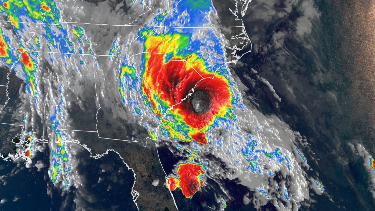
The storm made landfall less than two hours after the National Hurricane Center named it Bertha.
Bertha’s maximum sustained winds at landfall were 50 mph, up slightly from when it was named an hour before.
“The center of the circulation at 8 a.m. ET was a little over 30 miles offshore and is closing in fast,” CNN meteorologist Chad Myers said. “There will only be a small window of opportunity for more strengthening, but it is very warm water now it is certainly possible.”
Since 1900 having two named storms before the official start of hurricane season — June 1 — has only happened five times, said Phil Klotzbach research scientist in the Department of Atmospheric Science at Colorado State University.
Three of those have been since 2012, including this year.
The NHC issued a tropical storm warning for the coast of South Carolina from Edisto Beach to South Santee River.
“The center of Bertha will move onshore in the warning area in the next few hours and then move inland across eastern and northern South Carolina later today and into west-central North Carolina by tonight,” the NHC said.
The storm will cause flash flooding over portions of the Carolinas and very gusty winds.
Life-threatening surf and rip currents will be likely along the coasts of Georgia and the Carolinas throughout the day.